In a major setback to india , Nepal’s Parliament had on Saturday unanimously voted to amend the Constitution to update the country’s new political map, laying claim over three strategically Indian key areas Lipulekh, Kalapani And Limpiyadhura along the border with it.
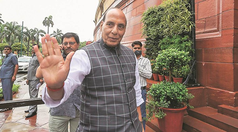
But today underscoring the development a legal impasse but by asserting that the road built by India till Lipulekh Pass is very much in its territory, Defence Minister Rajnath Singh said on Monday that his government believed in sorting out the “misunderstanding” in relations with Nepal through dialogue.
Also he added If the road built by India has caused any misunderstanding among the people of Nepal, then it will be sorted out through dialogue.
In an Election campaign a virtual rally for Uttarakhand , Singh underscored the deep ties between the two countries, saying they were bound together by “roti and beti”, and no power in the world can break it.
“Our relations are not only historical and cultural, but also spiritual, and India can never forget it,” he said. “How can relations between India and Nepal break!”
But Nepal’s Parliament unanimous resolution of passing new map made the water more murkier . The Nepal has taken a advantage position with the amendment of new map .
India if failed to act firmly in time with respect to the new map then chances are that Nepal’s Parliament endorsed deemed to a dispute site in future ..
The Kalapani region lies in a junction bordering three countries – India, Nepal and China.
Nepal and India both claim this region as part of their respective territories; India as part of Uttarakhand and Nepal as part of Darchula district.
Complicating the matter is the Sugauli Treaty – signed between the East India Company and Nepal in 1816 – which marks the Mahakali river as the western border of Nepal.
Subsequently, a number of British surveyors showed a different point-of-origin for the Mahakali river.
[splco_spacer]

[splco_spacer]
While India maintains that the river begins in the village Kalapani, Nepal claims that it begins from Lipulekh Pass. The contention here is that if the Mahakali river – considered the border between India and Nepal – had a different point-of-origin, the areas under the countries’ respective borders would be skewed.
If the river began at the point Nepal claims the Lipulekh Pass – then the Kalapani river would stretch longer, thereby affording a lengthier border between India and Nepal and giving India’s neighbour rights over the village of Kalapani.
India claims the ridge line towards the east of the Kalapani territory, and hence includes it in the Indian Union.
The strategic position of the 35-square kilometre region plays a huge part in this tug-of-war. India’s surveillance of Chinese movements are aided by the height of the Lipulekh pass.
Foreign affairs Experts in Diplomatic channel maintains that, “Nepal has laid claim to all areas east of the Lipu Gad, a rivulet that joins the river Kali on its border. The Nepalese contention is that the Lipu Gad is, in fact, the Kali river up to its source to the east of the Lipulekh Pass.
According to Nepal, after the India-China war in 1962, Nepal allowed Indian troops to occupy some posts in Nepal as a defensive measure. India has withdrawn from all of them, except Kalapani. It apparently wants to hold on to that post”.
Nepal’s ambassador to India, Nilambar Acharya, said that Nepal wanted a foreign secretary-level mechanism for resolving issues related to its borders, including the Kalapani issue.
[splco_spacer]


