Rough to very rough sea conditions are also likely in the west-central and south-western Arabian sea, and fishermen have been advised not to venture into these areas, warned IMD.
Arriving fresh surge of the westerly winds will intensify the monsoons in Kerala, Karnataka and the ghat areas of Tamil Nadu over 48 hours , while a dip in pressure in the Bay of Bengal will bring extremely heavy rain to Uttarakhand and Himachal Pradesh over 24 hours , the Indian Meteorological Department (IMD) forecast said on Monday.
Over the next 24 hours, “cyclonic circulation” or swirling winds associated with the pressure dip is likely to intensify in the Bay of Bengal will bring in heavy rain to eastern and northern India till Wednesday, including over isolated areas in Delhi and Uttar Pradesh, said the five-day forecast.

The low pressure area over northwest Bay of Bengal off West Bengal Coast and associated cyclonic circulation extending upto 7.6 km above mean sea level tilting southwestwards with height persists. It is likely to become more marked during next 24 hours.
Western part of the monsoon trough which is currently to the north of its normal position is likely to shift southwards gradually during next 3 days.
Under the above scenario, fairly widespread to widespread rainfall with isolated heavy to very heavy falls very likely over Western Himalayan region and eastern parts of India and heavy over Uttar Pradesh during next 23 days. Isolated extremely heavy falls are also likely over Himachal Pradesh and Uttarakhand during next 24 hours and over Odisha on 14th August IMD predicts

The rainfall activity over Kerala & Karnataka and Ghat areas of Tamilnadu is likely to increase in intensity once again during next 48 hours in association with a fresh surge of monsoon westerlies. Along with this, south Konkan & Goa is also likely to receive isolated heavy to very heavy rainfall.
“A low pressure area is forming in Northwest Bay of Bengal and neighbouring areas, which will bring rain across north and east India. Whenever there is a low pressure system, the Southwest monsoon winds gather speed and try to reach the low pressure area. This results in the moist winds crashing into the Western ghats and forming rain clouds over western part of the country, including Kerala,” said Dr Mrityunjay Mohapatra, senior IMD scientist.
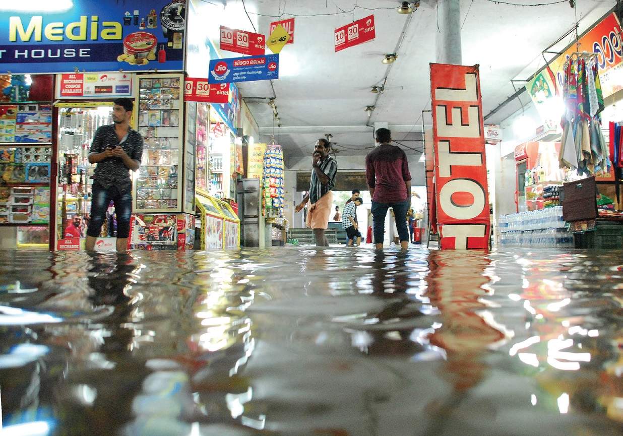
Rainfall in Kerala is likely to intensify over Tuesday, with most areas receiving heavy to very heavy rainfall till Wednesday, even as 11 of the state’s 14 districts battle flooding that has killed 40 persons and damaged more than 20,000 houses.
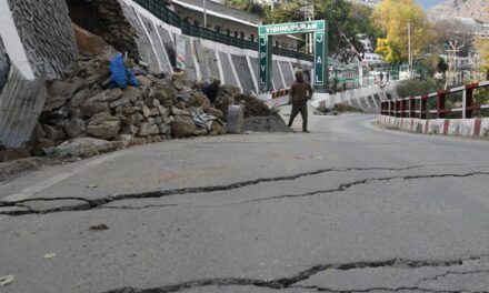
According to IMD data recorded at 8.30 am on Monday, the highest rainfall at 307 mm in the state was recorded in Sujanpur Tira. previously 277 mm rainfall was recorded in a day in August, 1901.Shimla, which had experienced a particularly parched summer this year, today witnessed the highest rainfall for August in 117 years, the weather office said.
Despite heavy rains in many part of India that has led to flooding and landslides, India’s monsoon deficit has gone up from 7% on August 1 to 10% on August 13. Kerala, however, has moved from normal to 20% excessive rainfall over last week.


