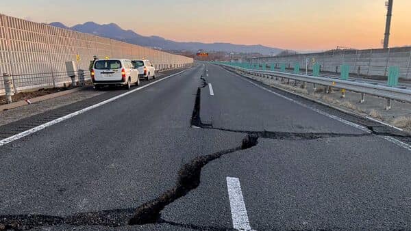
Several earthquakes of high intensity have hit Turkey and Syria since Monday killing over 10,000 people.
In India too, last month and before that, tremors of earthquakes were felt including in Delhi-NCR. Also cracks seen in Joshimath villages where more than 1000 buildings affected ..
According to the government of India, a total of nearly 59% of the land mass of India (covering all states of India) is prone to earthquakes of different intensities.
As per the seismic zoning map of the country, the total area is classified into four seismic zones.
Zone V is seismically the most active region, while zone II is the least.
Eight states and Union Territories are in zone-5 and are at risk of earthquakes of the highest intensity. The Delhi-NCR region is in zone IV.
Minister of state for Science & Technology and Earth Sciences, Jitendra Singh had informed the Lok Sabha in July 2021, that nearly 11% area of the country falls in zone V, 18% in zone IV, 30% in zone III and the remaining 41% in zone II.
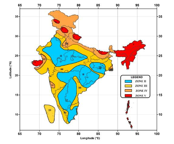
Percentage of India’s total landmass area in Earthquake Seismic Zone:
Zone V: 11% (most active)
Zone IV: 18%
Zone III: 30%
Zone II: 41% (least active)
States and UTs with cities and towns in zone 5 are Gujarat, Himachal Pradesh, Bihar (Darbhanga), Assam, Manipur, Nagaland, Jammu and Kashmir and Andaman & Nicobar.
Uttarakhand, where land subsidence was witnessed recently in Joshimath, is in zone IV.
Apart from this, Haryana, Punjab, Uttar Pradesh, Bihar, Chandigarh, and West Bengal are too in zone IV, the second-highest category.

